 Matt Ruta
Beaverfoot 3:1 – Chancellor and the Burning Truck

Oh, the north face of Chancellor Peak. If there’s one line that’s called to me above all others it’s this one. Visible from the ski hill and various other vantages around Golden, it’s a wall of white, smeared across an imposing rampart of peaks which seem to pierce the eastern sky. Add its location, in a wild, seldom visited valley in an utterly overlooked corner of the park and anyone who knows me should be able to imagine how I became so obsessed.


OLYMPUS DIGITAL CAMERA
The great thing about a face that visible, is that it’s easy to keep an eye on conditions. After some five years of scoping it out from a distance each spring, I was starting to feel like I had a decent handle on when it was in, and this May, it seemed in. All that was left was to wait for the right sequence of conditions. A cold snap, to tighten up the existing wet, warm snowpack. Check. Then a warm, wet beginning to a storm, to tack fresh snow onto the crust, followed by a cool finish for a layer of well bonded pow. Check. A quick punch of sun to test everything out and, finally, a good high pressure window. Check and check.
Now I just needed a partner. All the usual suspects were working but, conveniently, coastal crusher Eric Carter had just rolled into town. Over dinner, I convinced him to trust my judgement and set aside his reservations about the Rockies snowpack. He even compromised his principles on waking up early and agreed to a damn near alpine start.
It was a good thing too, because as we drove towards the trailhead, a plume of smoke rising above the highway around the next corner foretold disaster. Or at least inconvenience.
“What are the odds?”
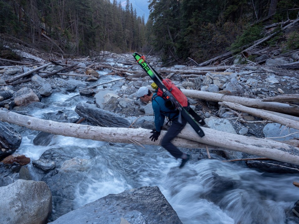
Rounding the bend, we found a burning semi occupying the highway just meters from our turnoff. It clearly wasn’t going anywhere soon, and neither were we, so we whipped a quick U-turn and parked back up the highway a few clicks instead. If we couldn’t drive to the trailhead, we’d just walk down the highway and sneak around the roadblock instead.
We jogged the road to make up time, and dispatched the Hoodoo Creek trail with similar efficiency. Soon enough we were bashing up the water worn rocks and tangled driftwood of the creek itself. “You’d think someone would build a trail here” mused Eric, vastly overestimating the amount of interest this area receives.
A full value approach

Intimidating, ain’t it!
Gaining the face is a bit of a thrash, requiring a nasty traverse across a thickly vegetated ledge to access a small, exposed snowfield and a largeish cliff band. Eric and I both switched to boots and crampons immediately after the traverse and got to work on the cliff band. Faced with a choice between overhanging snice (somehow) and loose drytooling, we settled on the latter, tentatively scratching our way onto the line itself with the help of some confidence inspiring tool sticks in the frozen moss.

Conditions were looking bulletproof and runneled at this lower altitude, but we pushed upwards, hoping skiability would improve as we went. Perhaps, we reasoned, the lower section would soften up later.
Our perseverance paid off before too long. Icy runnels gave way to consistent, fluted pow. I was hoping Eric would charge up the bootpack like the machine he is, but the elevation, deepening snow and endless booting took a toll on him too. We slowly swapped leads instead, grinding our way endlessly upwards. I’m not sure I’ve ever been on a face that’s so steep for so long.
Wild lines on Mt. Vaux beckoned across the valley and ravens swooped silently around us. Some 2000m below, and a world away, tiny traffic was moving on the highway again. The hiss of spindrift, heavy breathing and the rhythmic crunch of crampon and axe soundtracked a spectacular ascent.

A wild spot, with some mega lines on the south face of Vaux in the background.
Eventually, a small chute gained us the ridge, and a gorgeous view over the top. The From Rockies giants to the Bugaboos, with the towering Goodsirs front and centre. The Goodsirs! How often do you get to see them up close?
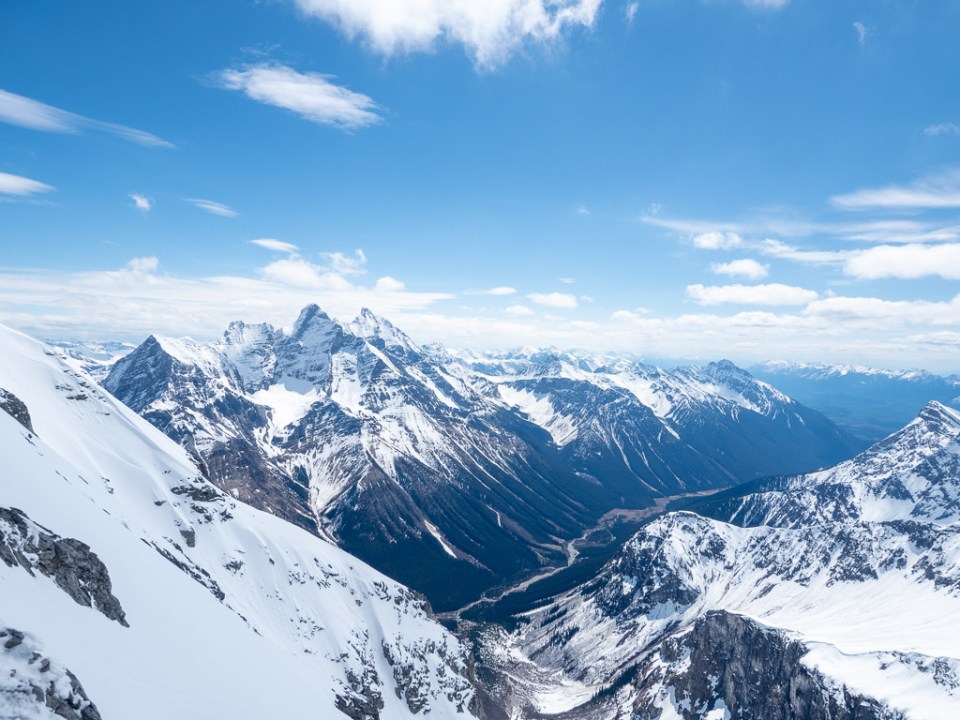
The Goodsirs loom over the Ice River valley
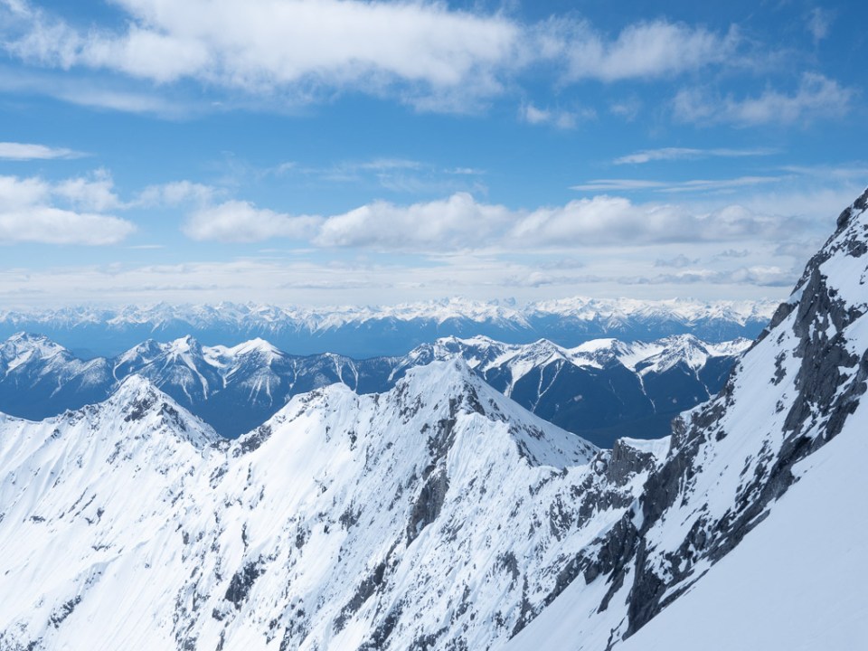
A fine view to the west.
It was quite frigid up there in the wind, and we transitioned quickly. Eric didn’t feel comfortable skiing off the ridge, so I rigged a quick belay to protect him while he downclimbed the chute. With more practice in this environment, I tossed the rope down and gingerly aligned myself on a solid looking snow mushroom before making a long turn through the chute and onto the open face.
Eric and I leapfrogged our way down from there, pausing at regular intervals to let our slough roar into the abyss. The position and snow quality couldn’t have been more spectacular, and the descent of the upper face was memorable indeed.
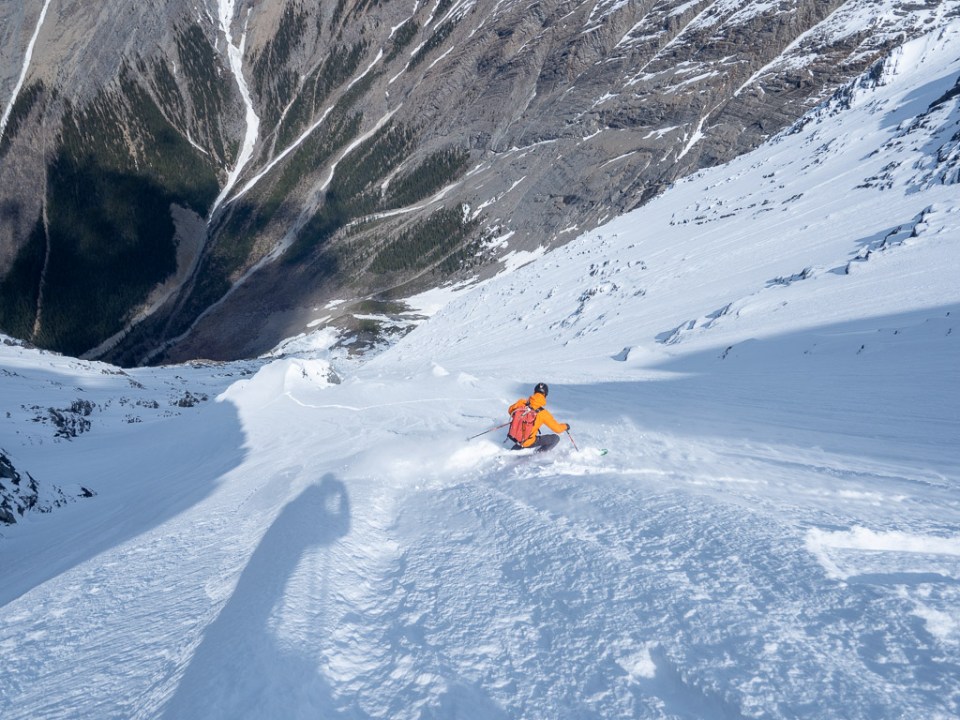
Eric uses a micro terrain feature to manage his slough midway down the face.
The lower third was memorable too, but not for the right reasons. It hadn’t softened one bit, and the exposure below was oh so real. Axes in hand, we picked our way down. Exhausting, exacting turns and a few side slips for the sake of self preservation took us back to the cliff band. Slowly and carefully, we reversed our earlier drytooling moves, this time without the benefit of the frozen moss.

Gross.

Eric searches fruitlessly for an easier way down. Ultimately we would head left from this rock fin to reverse our ascent route.
Then, the long plod back to the car. Both spent, but still buzzing from the events of the day, Eric and I chatted away an easy few hours. We didn’t even grumble too much at the extra 4 or 5 KM we had to walk to get back to the car.
