 Matt Ruta
Mt. Dennis Couloir

Finally, another exploratory mission. On the 28th, a spring temperature cycle was a little more locked in, but the weather remaining unsettled. It looked like a good time to check out a line I’ve been staring at from the highway near Field for years: the north facing couloir on Mt. Dennis.
There’s not a lot of beta around on this one, and the view from the highway doesn’t quite give a clean look. All I could find was an acknowledgement of its existence in the almighty Biglines Rockies Classics thread and a brief sidenote from Chris Brazeau mentioning that he had skied it in 2010. Since I’ve mostly been skiing in the Rockies the past few weeks though, I’ve been driving past it regularly, trying to get a feel for conditions and a reasonable approach every time the clouds allowed me a view. On my most recent pass through, the line looked filled in, so I took a minute to scope out an approach.
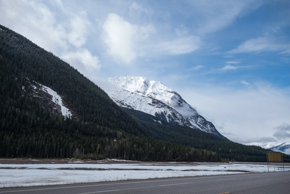
This view from the road has taunted me for ages.
I’m glad I did, because only a few days later I convinced Jason to come have a go at it with me. There are really two possible approaches; one goes up Stephen Creek, wrapping around to a high pass just east of the peak before dropping back down to the base of the line. It’s tough to tell from the highway, but this route looked a little rugged, so instead, we just thrashed directly up the slide path below the line from the Field back road. It was around this time that I noticed I forgot my camera, so other than the ones taken from the highway, all the photos in this trip report are from my cell phone. If you came for quality photography, now would be the time to stop reading.

The left gully looks inviting from the bottom, and from the top as a descent option. Don’t be fooled. The blue line may or may not go, but would decrease exposure to overhead hazard if it did. Green is our line of ascent and descent.
The path had run right to the road recently, so we were on snow right off the bat. Unfortunately, it was rock hard and increasingly steep, so we left our skis on our backs and booted up. At the first split, we stuck right. I remembered seeing water ice in the left gully from the highway. More booting led us to a second fork, where a small path split off to climber’s left (blue line in the photo). Again we stayed right, eventually meeting a small rock chute, which got us through a cliff band and onto a treed shoulder that we hoped signalled the end of the steep terrain.
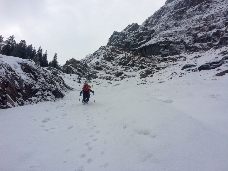
Typical terrain on the approach.
It didn’t. The crust was getting punchy, so we switched to skins and ski crampons to traverse the top of another path. During the changeover I managed to drop the bag containing said ski crampons and was forced to ski down 50m or so to retrieve them. Feeling like a proper idiot, I climbed a hard fought 150m or so of slick crust to Jason, who was waiting on another shoulder. This one was the gateway to the hanging valley we were looking for, and soon after we got our first close-up view of the couloir.


The only real difficulty we could see was a bit of a rock step about a third of the way up. With nothing for scale other than the couloir itself, it was hard to tell how big it actually was, but it didn’t look overly serious, so we started kicking steps again. Sure enough, once we got there we saw that it wasn’t so menacing, maybe 4 or 5 feet of actual vertical rock in the middle and much less on the sides. I scrambled up first, utilising good sticks in some soft ice to pull myself over before lowering my more capable axe down to Jason so he could do the same.

A look back about three quarters of the way up.
From there it was nothing but a bootpack through increasingly deep powder all the way to the top of the line. With overhead hazard looming, I pushed upwards as fast as I could until the pitch flattened just before the top. There, a small wind scoop afforded access to the ridge without dealing with the very ominous cornice, so we were able to eat some food, look around and relax a bit without fear of being squashed. The summit looked to be within easy reach, but with clouds rolling in and out and a low elevation exit to worry about, we just changed over at the top of the couloir.

Jason topping out.
Ski quality was glorious; deep, consistent pow for the entire top half of the line. Right from the top, our sloughs were running quickly, and Jason nearly got caught up by a particularly large one when a deep pile started to move at once. Nevertheless, we made it down to the crux move without incident. I hate downclimbing, and feel more comfortable on my skis anyway, so I sent it off the rock into a little straightline and shut down my speed easily in the soft snow. Leaving the ground wasn’t Jason’s cup of tea, so he switched to crampons and climbed down to the little alcove where I was hiding out.


From there it was strightforward skiing, following our ascent all the way back to the car. The snow got worse and worse as we descended, eventually turning to near mush peppered with loose rocks. Any later or warmer and we might have been skiing on the ground, but thankfully travel remained reasonable. All told it took about 8.5 hours car to car for a fun and aesthtic line.

Nice work, I’ve been looking at this for some time as well. Cool to see a proper report!