 Matt Ruta
Mt. Mummery Pt. 1: Exploration

In the mountains, the strategy is always to stack the deck as much as possible in your favour. Control every variable you can and leave as little as possible to chance, fate, luck or whatever phrasing makes you feel the most comfortable with it. That’s the way the game is played. Watch the line – sometimes for years, build the skillset, dial in the plan, the gear. Implicit in that strategy is the knowledge that there will be a time where it really doesn’t matter any more; a moment where it’s time go all in or walk away. On Mt. Mummery, Logan and I arrived at that point.
Standing on the summit we had a solid plan, all the beta we were going to get, and a deep desire to open the striking new line we were perfectly positioned for. Below us, the unskied north face began as an intimidating jumble of ice features, then just rolled away. The vast Mummery glacier stretched out far below, while the empty space between echoed the questions on both of our minds. “Are you good enough for this?”, whispered the wind. “Do you think you can pull it off?” called the raven circling overhead. With as much conviction as we could muster, we decided that we were willing to find out. Let me tell you about it.
I’ve been aware of Mt. Mummery as long as I’ve lived in Golden. It’s one of the biggest, closest peaks to town – just a short drive up the Blaeberry river. There’s a fairly popular hike to the toe of the Mummery Glacier and folks base camping on the Freshfield Icefield fly right over it, as well as sometimes skiing past it if they choose to make a human powered exit. The only mention of skiing the peak came from the old Biglines classics thread where someone mentioned the west face couloirs as a prime objective. Over the years though, I collected enough beta to see the fearsome north face as the mountain’s real king line – and I’d certainly never heard of anyone skiing or even climbing that.

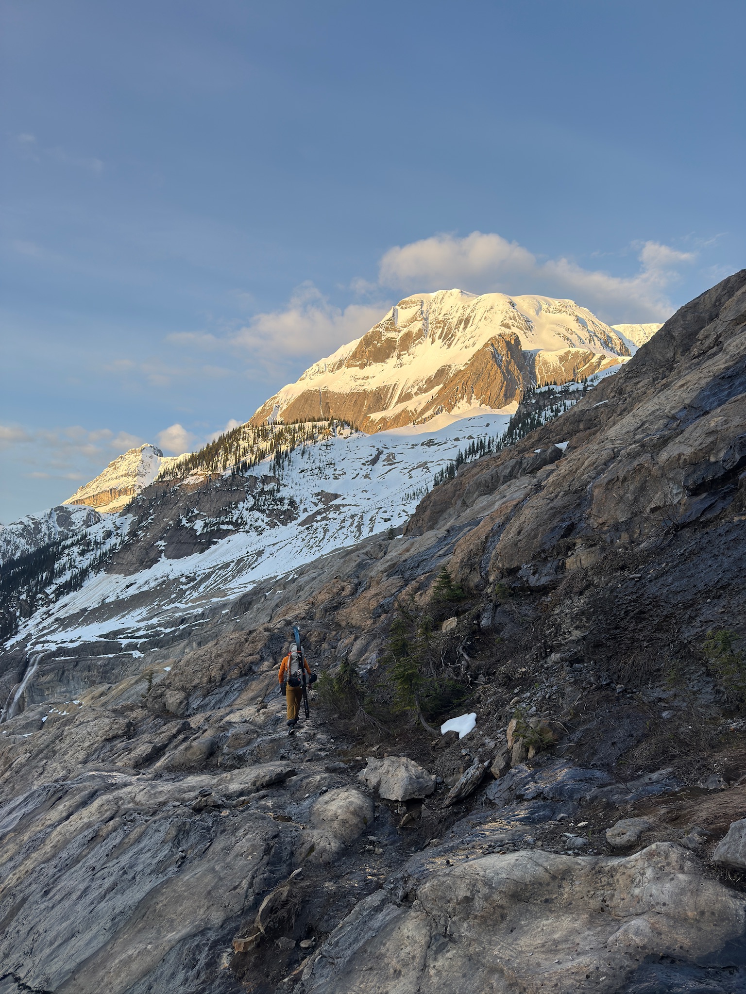
Logan peers up at Mt. Mummery from the road.
In 2021, the Alpine Club held their GMC at Mt. Mummery, where Dylan Cunningham and Tanya Bok made the first ascent of Smokeshow on the northeast buttress. That got me a whole slew of new beta and catapulted the peak towards the top of my to-do list. That was, of course, nearly four years ago but such is the process of lining up all the factors required to attempt such an objective. In May of this year, I felt I had the skills, conditions, window and motivation to make an attempt. Logan was game to join and with that, the plan lurched into motion.
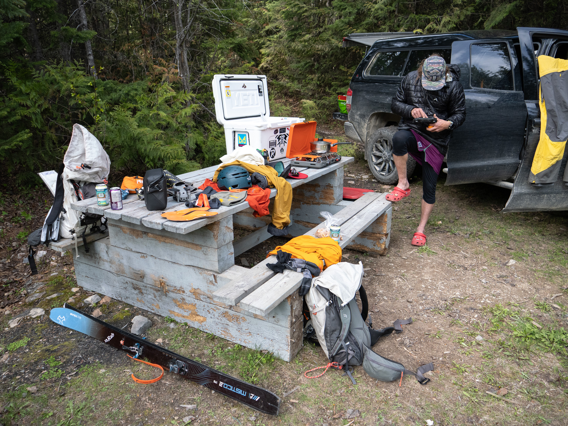
We had a two day window to play with, so step one would be to figure out the ascent route via the southeast ridge and see if we could even get up the thing. I’ve heard of attempts failing at the broken toe of the Mummery Glacier, plus the condition of the access trail and ridge itself were both relatively unknown to us. Logan and I made a comfortable base camp at the confluence of Mummery Creek and the Blaeberry River and turned in for a few hours rest at the decomposing rec site.
The trail was in pretty good shape. Old growth cedar forest like that doesn’t hold a lot of brush, so the first unknown of the day put up little resistance. From the end of the singletrack, cairns and intermittent bits of goat path helped us punch a nice route up moraine and slab towards the toe of the glacier. Days are long in late May and we hadn’t rushed out of our sleeping bags, so the navigation was quite straightforward in the early morning light. A good freeze allowed us to walk right to the edge of the glacier in our shoes. There, we deployed our high tech secret weapon: Logan’s drone. We used it to confirm a reasonable route through the crevasses to reach the southeast ridge, plus got a good look at the long, complicated exit from the north face. The face itself was too far away to look at. That would have to wait.
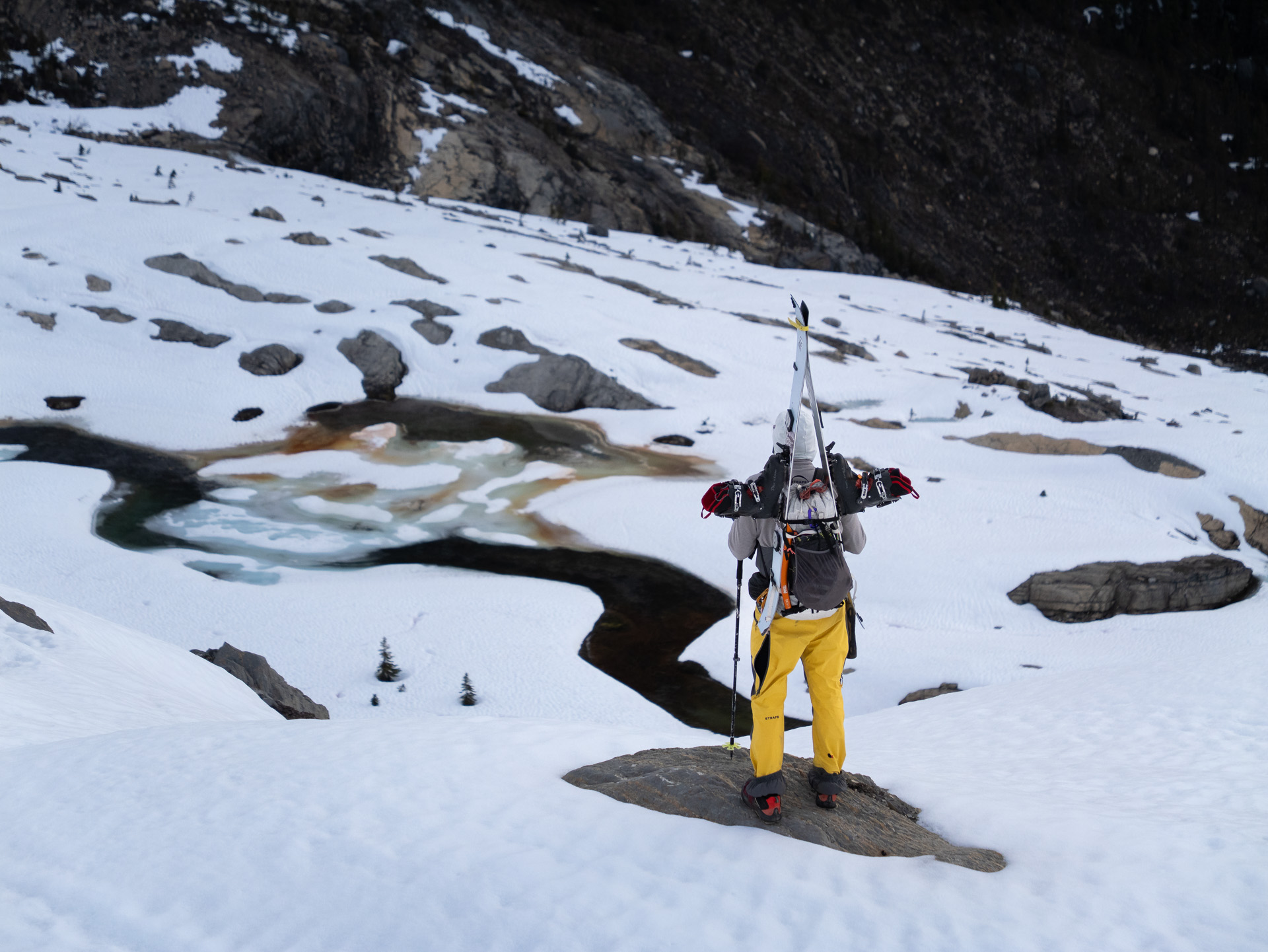


Typical terrain on approach and crossing the glacier.
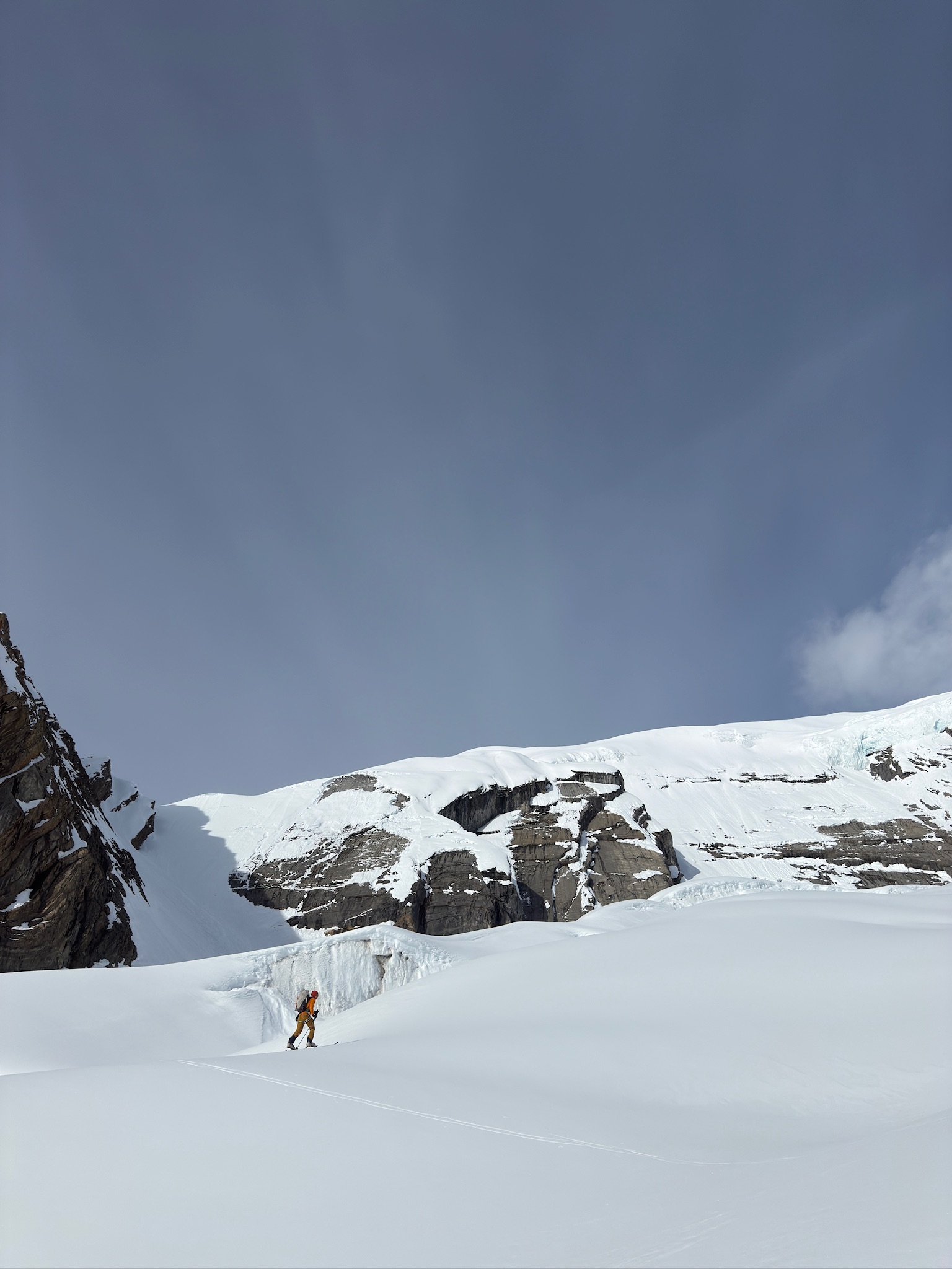
After grossing the glacier without incident the two of us punched up a gully to gain the ridge, then found we could pretty much skin the whole thing from there. That sounds simple enough, but this mountain is huge and our creek to peak approach made for a very long day. Above 2500m, 10-15cm of fresh snow afforded great conditions but didn’t give our legs any respite. Eventually we dragged ourselves into the huge glacial basin separating the mountain’s north and south summits. For today’s purposes, we would head up the south via its short but extremely steep east face.
The angle of the slope made for quite a deep trailbreaking experience, so it took longer than we’d like to admit for us to complete a trench to the summit. Or, I should say, to the skier’s summit. The true peak is a rocky pinnacle guarded by double corniced ridge and dizzying exposure. Both Logan and I were happy to pass on that and devote our time to drone scoping instead. Ice is perhaps the worst material for drone controller signals to operate around, so we had to fly quite high to get our beta. Still, we could see a clear route down the north face and excitement was starting to build. A few cruxes would need further inspection back at camp, but this was a very good start.


Ski conditions on the east face were nothing short of glorious. It’s a type of face you find occasionally in the Rockies – short and concave, which must provide a little extra support for steeper ice and snow to cling to terrain that it shouldn’t. I don’t know what the exact angle of the pitch is, but in cold, fast sloughing pow it was a very enjoyable 150 odd meters indeed. From there it was an fun but not particularly noteworthy ridge ski, retracing our steps back to the glacier and our shoes. I’d absolutely recommend the southeast ridge as a ski mountaineering objective, but as much for the mountaineering as the skiing. Logan and I stashed some gear. We’d be back tomorrow, we decided.


Now satisfied with the day, we started to leave but the day was surely not satisfied with us. A solid 900m of dry, slabby moraine lay below and with heavy packs and tired legs we wanted nothing to do with it. We’d caught a glimpse of avalanche debris over towards Mummery Creek, so we figured we’d try to wring a little extra vert out of that. Some downhill bushwhacking on ten, then five, then two cm of snow ensued, but just when we were about to give up hope, the slide debris appeared.
Was it good skiing? No, absolutely not. Was it better than walking? Definitely. This miracle slide path had filled the creek to within 200 vertical meters of the trail, and we were pretty elated to avoid any downhill pounding that we could. I had a noticeably better time on my skis than Logan on his splitboard, but we both managed. Still, it was a long day and we finally arrived back at camp about 12 hours after leaving it. A very involved scoping day no doubt, but a successful one.
The rest of the day was spent poring over drone photos, speculating, packing, unpacking and repacking gear. Do we need rock pro? Probably not but let’s pack it anyway. Extra v-threader? Definitely. How many screws? More.
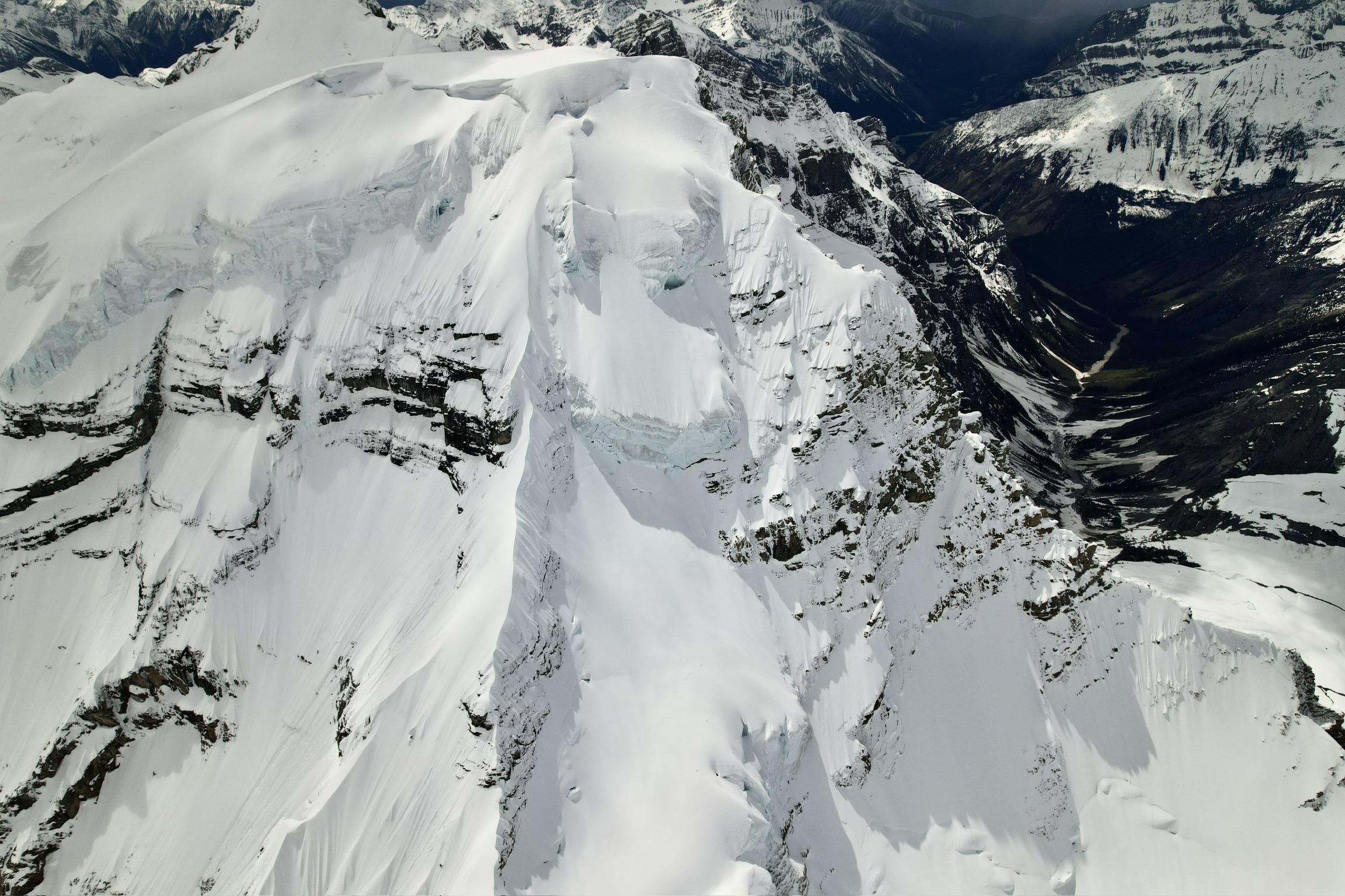

Left: The drone photo we spent our evening obsessing over. Top Right: the most useful slide path I’ve ever found.
Gear faffing is a wonderful way to pass the time and an excellent distraction. Thought neither of us had outright committed to the north face the following day, the photos looked good and the objective had more or less clicked into place on its own. We had a plan for each crux in the line, and backup plans if those didn’t work. As prepared as we were going to get, we set a 02:30 alarm and each fell into an uneasy sleep before sunset.

Pingback: Mt. Mummery Pt. 2: Conviction | Matt Ruta